Makani
sail more, work less...
reisen ist die sehnsucht nach dem leben
kurt tucholsky
MotionX navigation by satellite pictures
 |
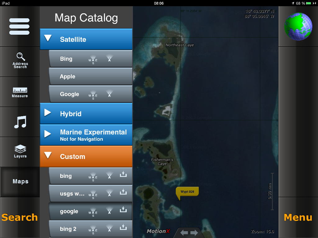
I use a very good app to navigate when charts are not accurate. on the picture left you can see my navigation on lighthousereef in belize, where we went to visite the blue hole the next day. this app is ONLY available for iOS, needs a built in GPS and can downloaded for free on following website: http://gps.motionx.com After downloading, you need to purchase the function to add "Customs Maps". this is necessary, because only customas map can be saved on you device offline. this feature costs about 5 US$ Instruction: Once downloaded, open the app and go to: -> Menu -> Setup -> Customs Maps -> New here the app wants you to buy the function, get connected and get it. |
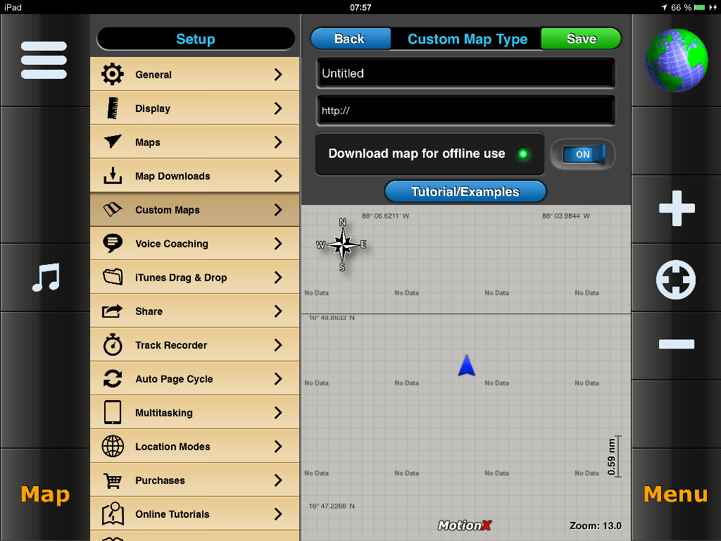 |
once done, come back here and fill in following fields: Untiteled -> change to GOOGLE http://mt1.google.com/vt/lyrs=y&x=[X]&y=[Y]&z=[Z] Download map... switch to -> ON and then clic the green button SAVE take care on correct typing, incude all brackets and everything. when correct and you are online, you should see a satellite view of the aera. (where it is grey on my sample) |
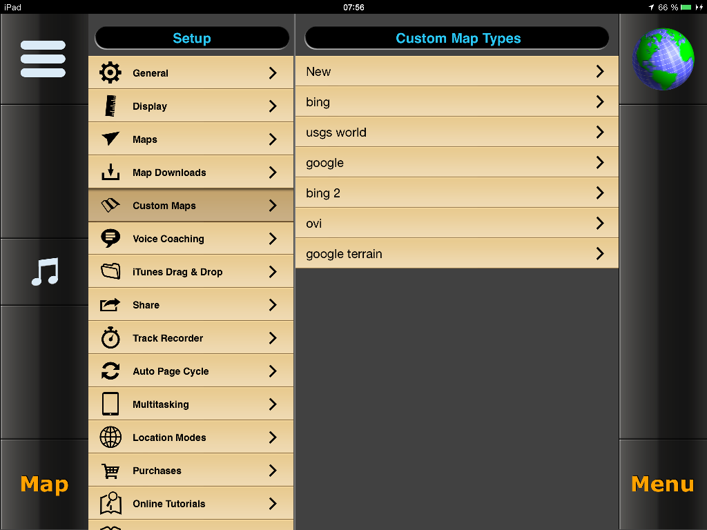 |
do the steps above again for all servers. at the end you'll have three servers. on my sample i have more than three, but those two plus the one above are the best: ArcGIS OVI a list of all three servers is here |
why multiple servers? some satellite pictures are better from google, some better from ArcGIS or OVI:
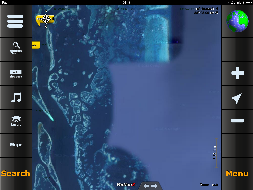
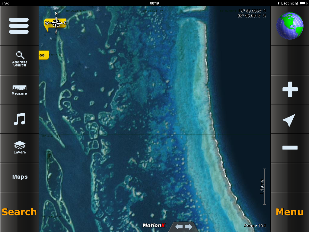
example: the same region, google (left) does not provide the right pictures. dont ask me why. better results here is OVI. just check before you start downloading. |
|
|
Download a Map: to download a map for offline, you need to get online first and look your aerea if all pictures are good. clic on the left screen -> Maps and use on of your Custom map with (+) and (-) on the right screen, zoom in and out, scroll to your desired spot. the arrow between the two zoom buttons brings you to your actual gps position. |
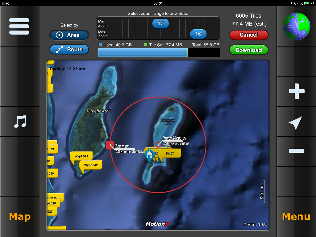 |
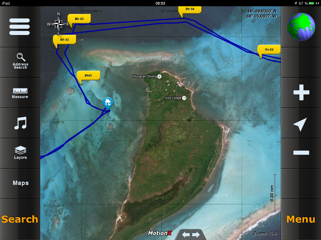
once satisfied, clic on: -> Menu -> Setup -> Map Downloads -> Download New Maps -> choose your map. then you see the pictures on the left. MinZoom and MaxZoom are very importand, that reduce or increase the downloadsize very much! so have always a look on the est. downloadsize before start downloading. a MaxZoom of 15 is often enough to navigate. also try Route instead of Area. this will change the size also a lot. when ready, clic on Download A Download picture does appear and shows you the status quo while downloading. after finished, go on the field "Map Tile Set 001" and change it to your subject. clic Back. Check it alwas. GO OFFLINE, and clic on the mainscreen -> Maps -> your Custom Map and check. once starting navigation, it will draw a trackingline where you are and where you should go. see sample picture on top. good luck, claudio |